NASA Starling Mission Achieves Breakthrough in Autonomous Deep-Space Navigation Without GPS

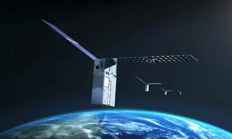
In an unprecedented milestone for autonomous spaceflight, NASA’s Starling mission has successfully demonstrated a revolutionary navigation system that allows a satellite to determine its exact orbital position using other objects in space as reference points. Operating independently of ground-based tracking stations and traditional Global Positioning Systems (GPS), this cutting-edge capability marks a monumental shift in how spacecraft will navigate the cosmos. As humanity looks toward sustained exploration of the Moon, Mars, and deep space, the successful trial of this technology heralds a new era of spacecraft self-reliance.
The core of this breakthrough is an innovative technology called FALCON, which stands for Fast Autonomous Lost-in-space Catalog-based Optical Navigation. Designed to empower spacecraft with unprecedented operational independence, FALCON addresses one of the most persistent engineering challenges in aerospace history: navigating regions of space where Earth-based signals are completely unavailable.
The Evolution of Deep-Space Navigation Challenges
For decades, satellites operating in Low Earth Orbit (LEO) and Medium Earth Orbit (MEO) have relied heavily on GPS and other Global Navigation Satellite Systems (GNSS) to maintain their trajectories, synchronize clocks, and execute precise maneuvers. However, these vital signals degrade exponentially with distance. Once a spacecraft ventures beyond Earth’s immediate orbital sphere—such as into cis-lunar space, the lunar surface, or interplanetary trajectories—GPS signals become too weak to be useful or vanish entirely.
Traditionally, maintaining spacecraft positioning in deep space has required a heavy reliance on NASA’s Deep Space Network (DSN) and an army of dedicated flight controllers on Earth. Ground stations must constantly ping spacecraft, calculate trajectories, and upload corrected orbital parameters. This ground-in-the-loop paradigm introduces latency, consumes vast amounts of institutional resources, and creates vulnerabilities if communication links with Earth are disrupted.
As NASA and international space agencies prepare for an exponential increase in lunar missions, satellite constellations, distributed scientific observatories, and crewed voyages to Mars, relying on Earth-tethered navigation has become an operational bottleneck. FALCON shatters this limitation by shifting the burden of navigation from the ground to the spacecraft itself.
Anatomy of the FALCON Experiment
The FALCON payload is a sophisticated joint flight experiment developed collaboratively by NASA and EraDrive, a nimble aerospace startup that originated as a research initiative at Stanford University. The technology harmonizes EraDrive’s proprietary Era-Core flight software and embedded algorithms with the robust hardware architecture of the Starling spacecraft—specifically utilizing its onboard star tracker cameras and an extensive catalog of known orbital objects.
Starling’s star tracker cameras are standard instruments typically used to orient a spacecraft by identifying constellations and bright stellar bodies. However, FALCON repurposes these high-precision optical sensors to track dynamic objects closer to home, including other active satellites, defunct spacecraft, and orbital debris.
By combining optical observations with an onboard catalog loaded with approximately 20,000 known space objects and their predicted orbits, FALCON empowers the spacecraft to execute complex positioning computations entirely on its own. The system matches what the cameras see with cataloged trajectories, triangulates its position against these moving reference points, and calculates its precise orbit without a single command from Earth.
Chronology and Execution of the Starling Mission Milestones
The path to this technological triumph began years ago as a university research initiative under NASA’s SmallSat Technology Partnerships program. What started as theoretical software development matured into a robust commercial application through EraDrive, paving the way for orbital validation.
The Starling mission itself was successfully launched in 2023, designed explicitly as a testbed for swarm technologies, autonomous coordination, and resilient distributed systems. Managed by NASA’s Ames Research Center in California’s Silicon Valley and funded by the Small Spacecraft and Distributed Systems program within the agency’s Space Technology Mission Directorate, Starling has continually pushed the boundaries of small satellite capabilities.
The recent FALCON demonstration unfolded over a rigorous three-day testing protocol in low Earth orbit. During this period, the Starling spacecraft evaluated two primary autonomous capabilities:
First, the spacecraft conducted position, navigation, and timing (PNT) experiments. FALCON successfully identified nearby spacecraft and orbital debris using Starling’s star tracker cameras, cross-referenced them with the Department of Defense’s public space object catalog, and utilized those dynamic entities as celestial navigation beacons to compute its own orbit.
Second, the mission executed catalog-updating experiments. Rather than simply reading the pre-loaded catalog data, FALCON actively compared optical observations against predicted trajectories. By processing these real-time visual measurements, the system not only calculated Starling’s precise position but simultaneously refined the estimated locations of more than 200 other tracked objects. Remarkably, the orbital estimates generated autonomously by the spacecraft were significantly more precise than the legacy catalog data supplied by ground stations.
Official Responses and Industry Implications
The success of the FALCON experiment has sent ripples of enthusiasm through the aerospace engineering community, validating years of public-private partnership between NASA and emerging commercial ventures.
"FALCON is yet another success for the Starling demonstration mission," stated Roger Hunter, program manager for NASA’s Small Spacecraft and Distributed Systems program at NASA’s Ames Research Center. "The results from FALCON can have far-reaching implications for on-orbit space-traffic monitoring, collision avoidance, and alternative navigation. The number of ‘firsts’ from Starling just keeps growing."
Industry analysts note that the implications of FALCON extend far beyond simple satellite positioning. As the orbital environment becomes increasingly congested with commercial mega-constellations and defunct hardware, space traffic management (STM) has emerged as a critical global security and operational concern. Current STM systems depend heavily on ground-based radar and optical telescopes, which can be hindered by weather, geographical limits, and tracking backlogs.
By decentralizing tracking and enabling satellites to autonomously update orbital catalogs and monitor their surroundings, missions like Starling offer a scalable blueprint for managing orbital congestion. Spacecraft equipped with optical navigation and catalog-refining software can actively contribute to situational awareness, drastically reducing the risk of catastrophic space collisions.
Future Horizons for Autonomous Spaceflight
The validation of FALCON represents a historic first: a spacecraft successfully navigating using optical cameras keyed to relative positions among other space objects, while simultaneously upgrading catalog data better than ground-based stations. However, NASA’s roadmap for Starling does not end here.
Later this year, the Starling mission will enter its next ambitious phase. The mission’s four distinct spacecraft will begin sharing tracking information directly with one another across an inter-satellite network. By combining these multi-point optical observations collectively, the swarm will further refine their respective positions and demonstrate coordinated, autonomous swarm navigation in real-time.
This capability is foundational for future distributed science missions—such as multi-point heliophysics observatories or deep-space interferometers—where precise relative positioning among multiple spacecraft is mandatory to align scientific measurements accurately. Furthermore, as humanity establishes permanent infrastructure on the Moon through the Artemis program and looks ahead to crewed missions to Mars, autonomous navigation networks will serve as the invisible infrastructure supporting rovers, communication relays, habitats, and logistics chains.
By successfully bridging academic innovation with rigorous orbital testing, the NASA Starling mission and EraDrive have laid a cornerstone for the future of space exploration. As spacecraft take their first independent steps away from Earth’s electronic apron strings, technologies like FALCON ensure they will never truly be lost in space.
Related posts: